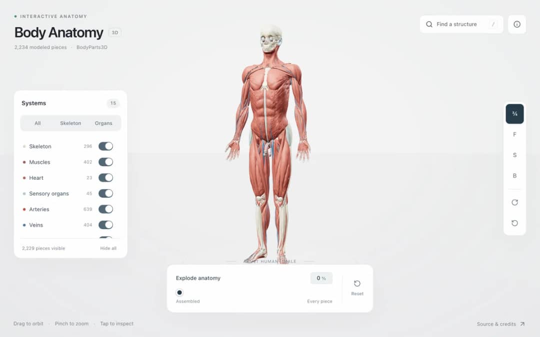
Explore an adult male reference body in 3D. Reveal 14 anatomical systems, search thousands of named structures, isolate organs, and pull 2,209 modeled pieces apart to see how the body is organized.
—
KiwiBee uses optional Google Analytics, Google Ads, and Meta Pixel cookies to understand adult visitors, measure completed sign-ups, and improve campaigns. Essential cookies always stay on. OpenAI’s ChatGPT Ads Pixel also measures page views and completed enquiries after advertising consent, and may use hashed contact details for matching. Privacy policy
Ocean Conveyor & Upwelling is a 3D physical oceanography simulation connecting density-driven thermohaline overturning (AMOC) with wind-driven coastal Ekman upwelling. In the polar sinking zone on the left, warm red surface water cools and becomes denser, plunging into the abyss as cold blue North Atlantic Deep Water measured in Sverdrups (Sv). Along the eastern continental shelf on the right, surface trade winds push warm water offshore, tilting the blue thermocline upward and drawing green nutrient-rich deep water into the sunlit euphotic zone. Students can drag the wind arrow or polar iceberg, test freshwater melt slowdowns, and switch into El Niño Shutdown mode.
Thermohaline circulation is driven by differences in seawater density caused by temperature and salinity. As warm salty Gulf Stream water travels north, it loses heat to the Arctic air and becomes denser as sea ice forms and leaves salt behind, causing it to sink.
Melting glaciers and sea ice add low-density freshwater to the North Atlantic surface ocean. This dilutes the salt concentration, making the cold surface layer too buoyant to sink rapidly into the deep ocean and reducing overturning transport.
When winds push warm, nutrient-poor surface water away from the coast, cold deep water rises to replace it. This deep water is rich in nitrates and phosphates from decayed organic matter, fueling phytoplankton blooms and major fisheries.
During El Niño, the Pacific trade winds weaken or reverse. Warm surface water piles up against the South American coast, depressing the thermocline deep below the surface and preventing cold, nutrient-rich water from upwelling.
Drop it into your LMS, blog, or class site — free.
<iframe src="https://kiwibee.io/en/simulations/thermohaline-ocean-conveyor-3d-simulation/embed" title="Ocean Conveyor & Upwelling | KiwiBee" loading="lazy" allowfullscreen style="width:100%;height:min(70vh,620px);min-height:420px;border:0;border-radius:16px"></iframe>Continue exploring
Explore an adult male reference body in 3D. Reveal 14 anatomical systems, search thousands of named structures, isolate organs, and pull 2,209 modeled pieces apart to see how the body is organized.
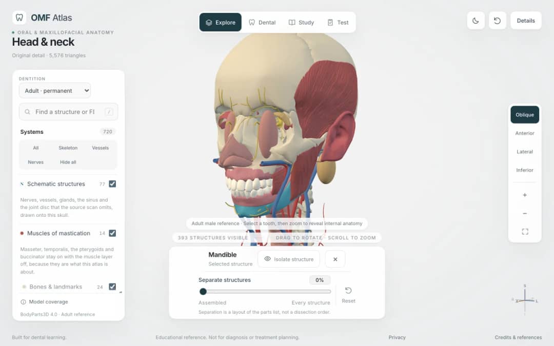
Explore the head and neck in 3D: 643 source meshes across 14 layers, 47 facial and masticatory muscles, and 77 drawn nerves, vessels and glands the source scan omits. Open any tooth onto its own pulp canal, and follow the seven stages of tooth development.

Free interactive photosynthesis simulation. Explore photosynthesis hands-on online — great for whole-class or independent practice.

Free interactive states of matter simulation. Explore states of matter hands-on online — great for whole-class or independent practice.

Free interactive shadows simulation. Explore shadows hands-on online — great for whole-class or independent practice.
KiwiBee's free teacher workspace brings lesson planning, worksheets, classroom tools, and gradebook together in one place.
Start free and create your first class Home
 All solutions
 Pricing
 About us
 KiwiBee for Non-profits
 Events & webinars
 For big organisations
 For schools
 For centers
 For team leaders
 For teachers
 AI and resources
 Resources
 Printable worksheets
 Lesson Packs
 Interactive simulations
 Teacher tools
 AI studio
 Ideas and research