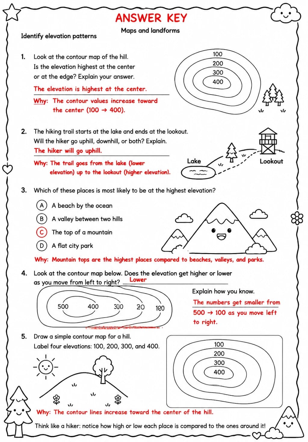
Identify elevation patterns
Free printable Grade 4 science worksheet for "Identify elevation patterns" — practice maps and landforms. No-prep, print or assign online.
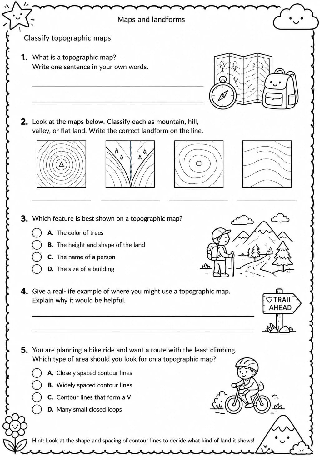
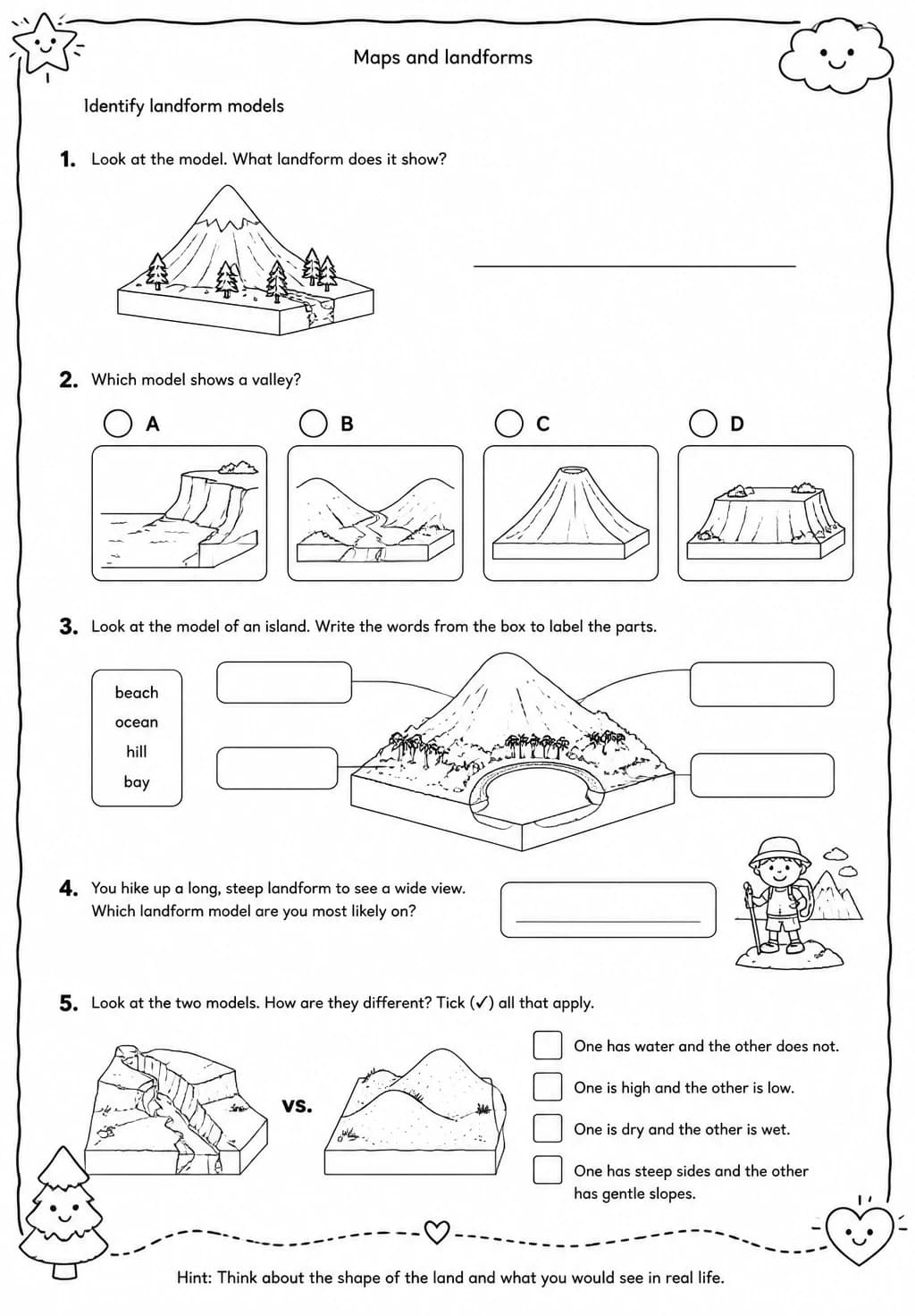
This Grade 4 Earth Science worksheet builds students ability to identify elevation patterns on maps, helping them interpret topographic information and connect physical map features to real landforms. Teachers can use it after introducing map reading and landform vocabulary, or as a structured practice activity within the Maps and Landforms substrand. Students develop the spatial reasoning and map literacy skills that are foundational for geography and earth science.
Learning objectives
- Identify and describe elevation patterns shown on topographic or physical maps
- Explain how contour lines or color shading represent changes in elevation
- Connect elevation patterns on maps to real landforms such as mountains, valleys, and plains
Answer Key
How to use this worksheet
- Click “Download Worksheet” and sign in with Google or email to get the PDF instantly.
- Print at home or in class for Grade 4; it's no-prep, with no extra materials needed.
- Use the included answer key to mark it in seconds.
Frequently asked questions
Is the “Identify elevation patterns” worksheet free?
Yes. “Identify elevation patterns” is a free printable Science worksheet. Sign in with Google or email to download the PDF instantly.
What grade or age is this Science worksheet for?
It's designed for Grade 4 (ages 9–10), covering Maps and landforms.
Does it come with an answer key?
Yes — a matching answer key is included so you can grade it in seconds.
Create more worksheets in our Worksheet Studio
Generate fresh worksheets for any grade, topic, and language — free.
Open the Worksheet StudioMore for Grade 4
You might also like
Life Cycles Trivia Quiz — Grade 4 | Free Classroom Game
Life Cycles Spin-the-Wheel Game — Grade 4 | Free Classroom Game
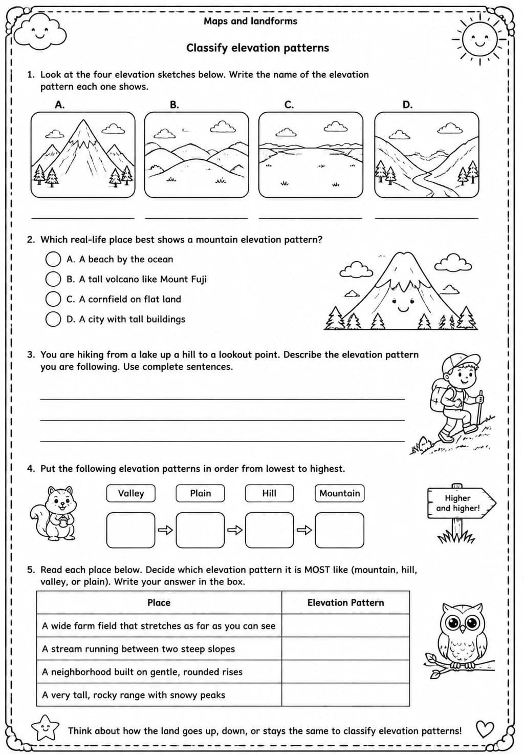
Classify elevation patterns
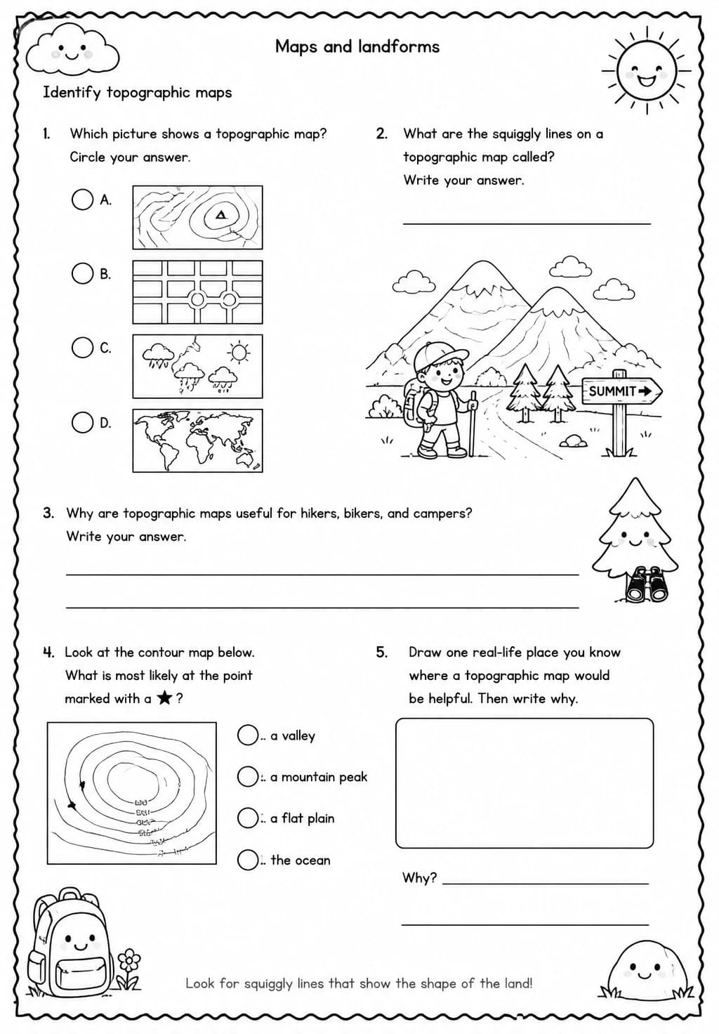
Identify topographic maps
Identify landform models