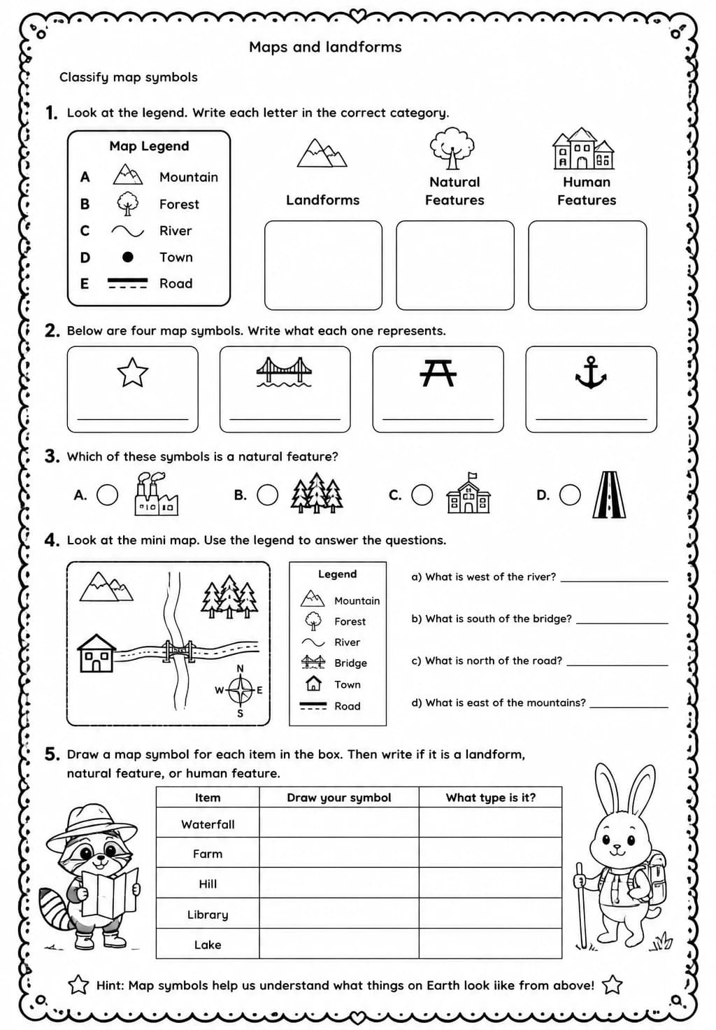
Classify map symbols
Free printable Grade 4 science worksheet for "Classify map symbols" — practice maps and landforms. No-prep, print or assign online.
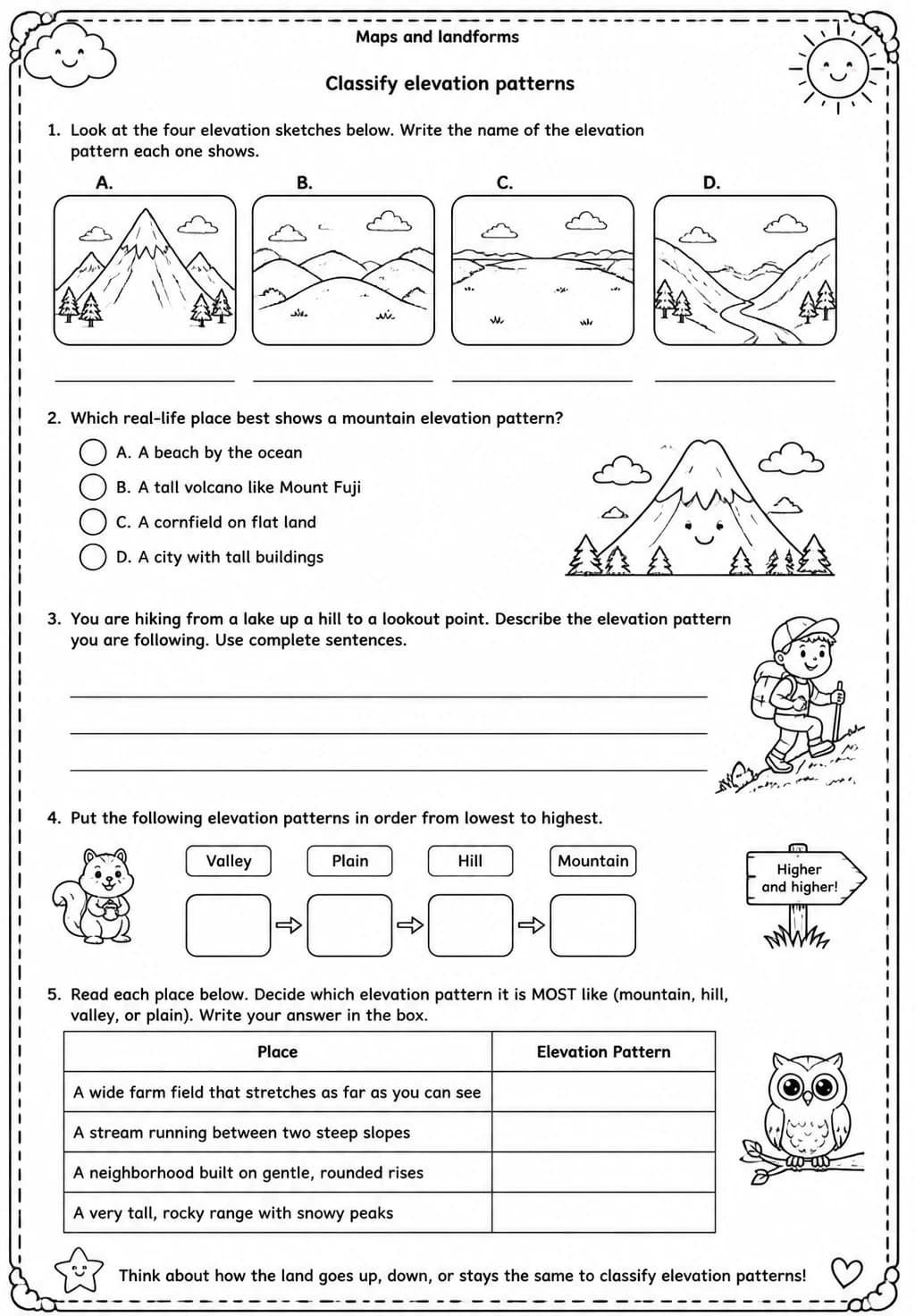
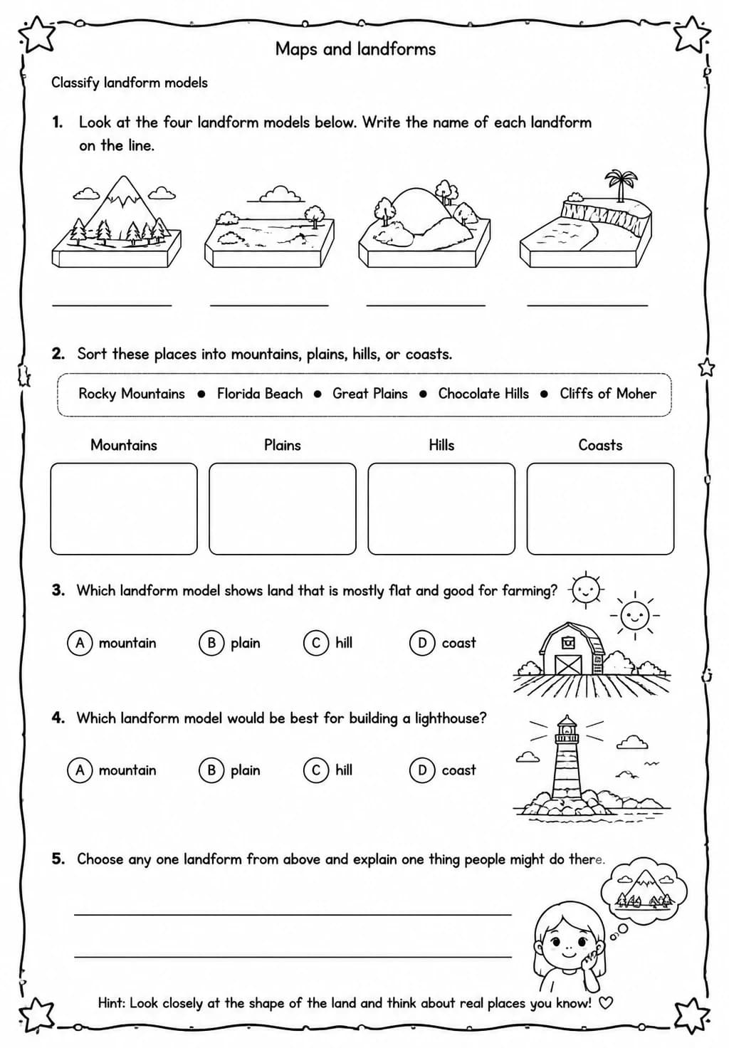
Grade 4 students learn to classify the symbols found on maps — including those for cities, roads, bodies of water, and elevation — as part of a broader understanding of how maps communicate geographic information. This Earth and Space Science worksheet on Maps and landforms guides learners to decode map legends and apply symbol knowledge to real-world spatial thinking. Being able to read and classify map symbols is a key geographic literacy skill that supports social studies and earth science learning.
Learning objectives
- Identify and classify common map symbols using a map legend
- Explain what different map symbols represent and why standardized symbols are used
- Apply symbol knowledge to extract geographic information from a simple map
Answer Key

How to use this worksheet
- Click “Download Worksheet” and sign in with Google or email to get the PDF instantly.
- Print at home or in class for Grade 4; it's no-prep, with no extra materials needed.
- Use the included answer key to mark it in seconds.
Frequently asked questions
Is the “Classify map symbols” worksheet free?
Yes. “Classify map symbols” is a free printable Science worksheet. Sign in with Google or email to download the PDF instantly.
What grade or age is this Science worksheet for?
It's designed for Grade 4 (ages 9–10), covering Maps and landforms.
Does it come with an answer key?
Yes — a matching answer key is included so you can grade it in seconds.
Create more worksheets in our Worksheet Studio
Generate fresh worksheets for any grade, topic, and language — free.
Open the Worksheet StudioMore for Grade 4
You might also like
Life Cycles Trivia Quiz — Grade 4 | Free Classroom Game
Life Cycles Spin-the-Wheel Game — Grade 4 | Free Classroom Game
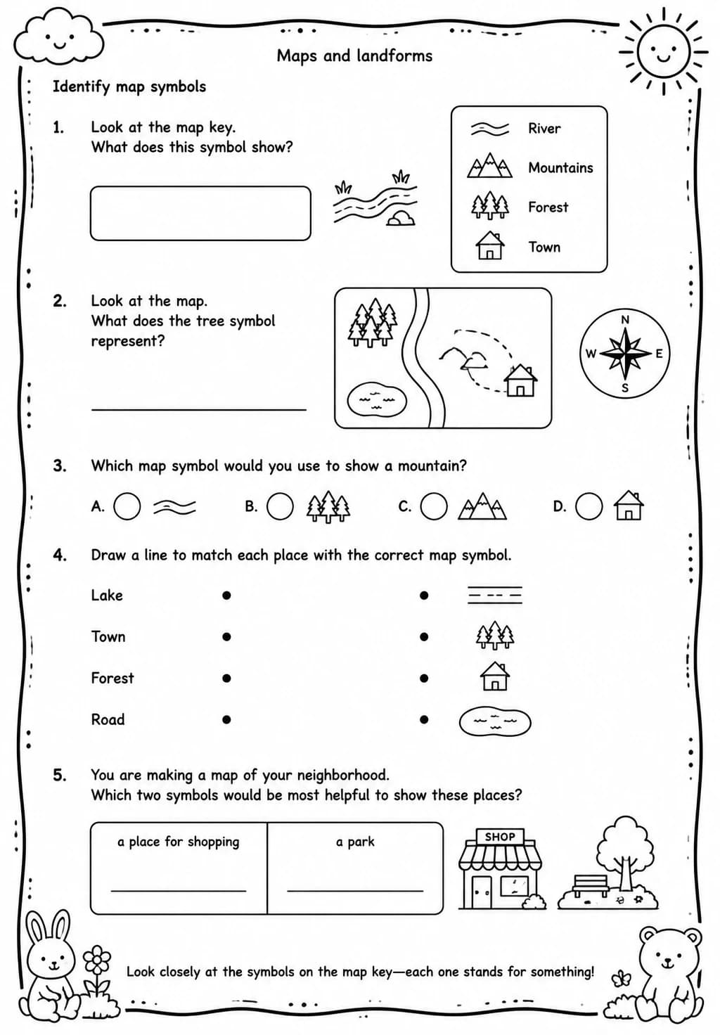
Identify map symbols
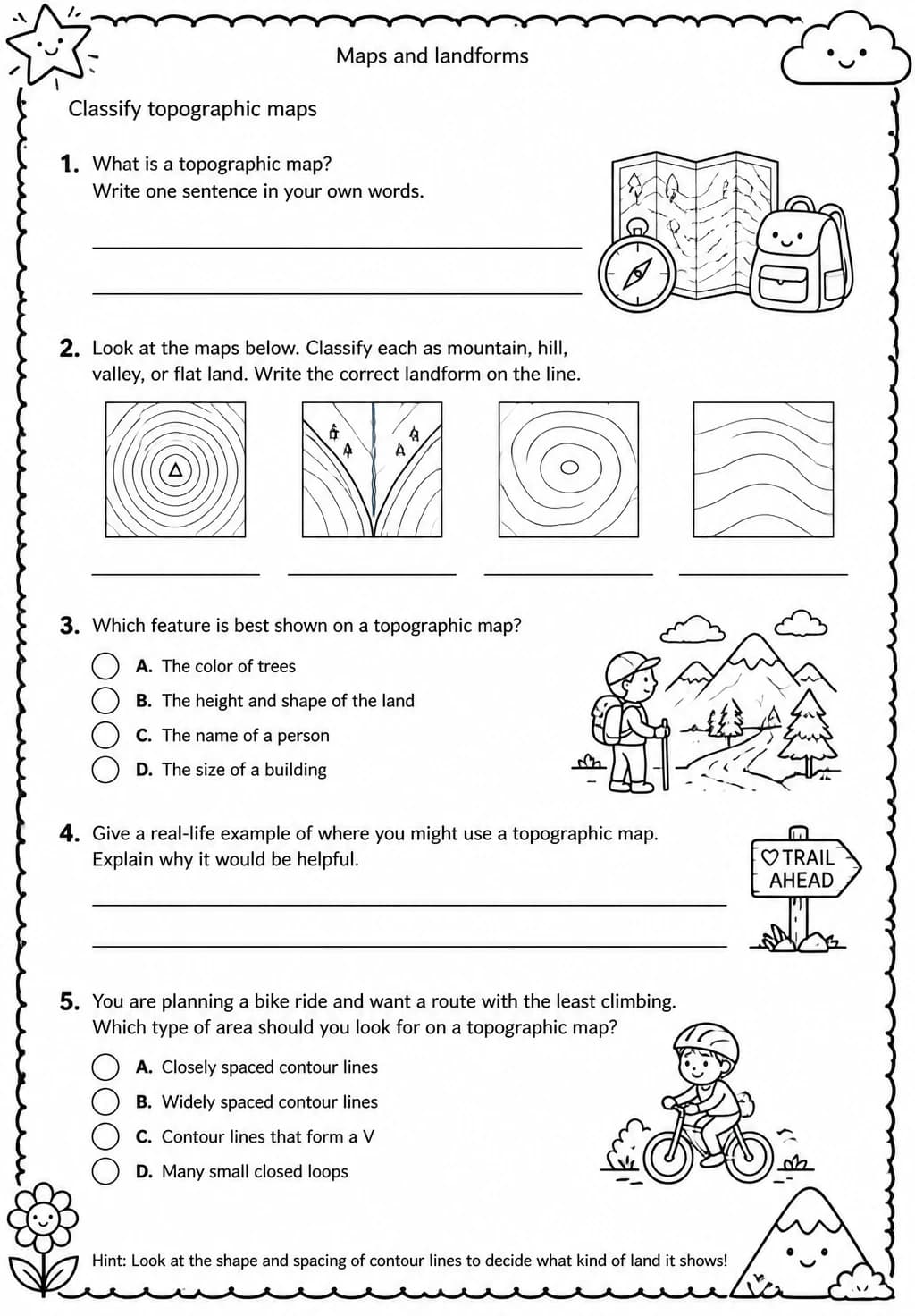
Classify topographic maps
Classify landform models