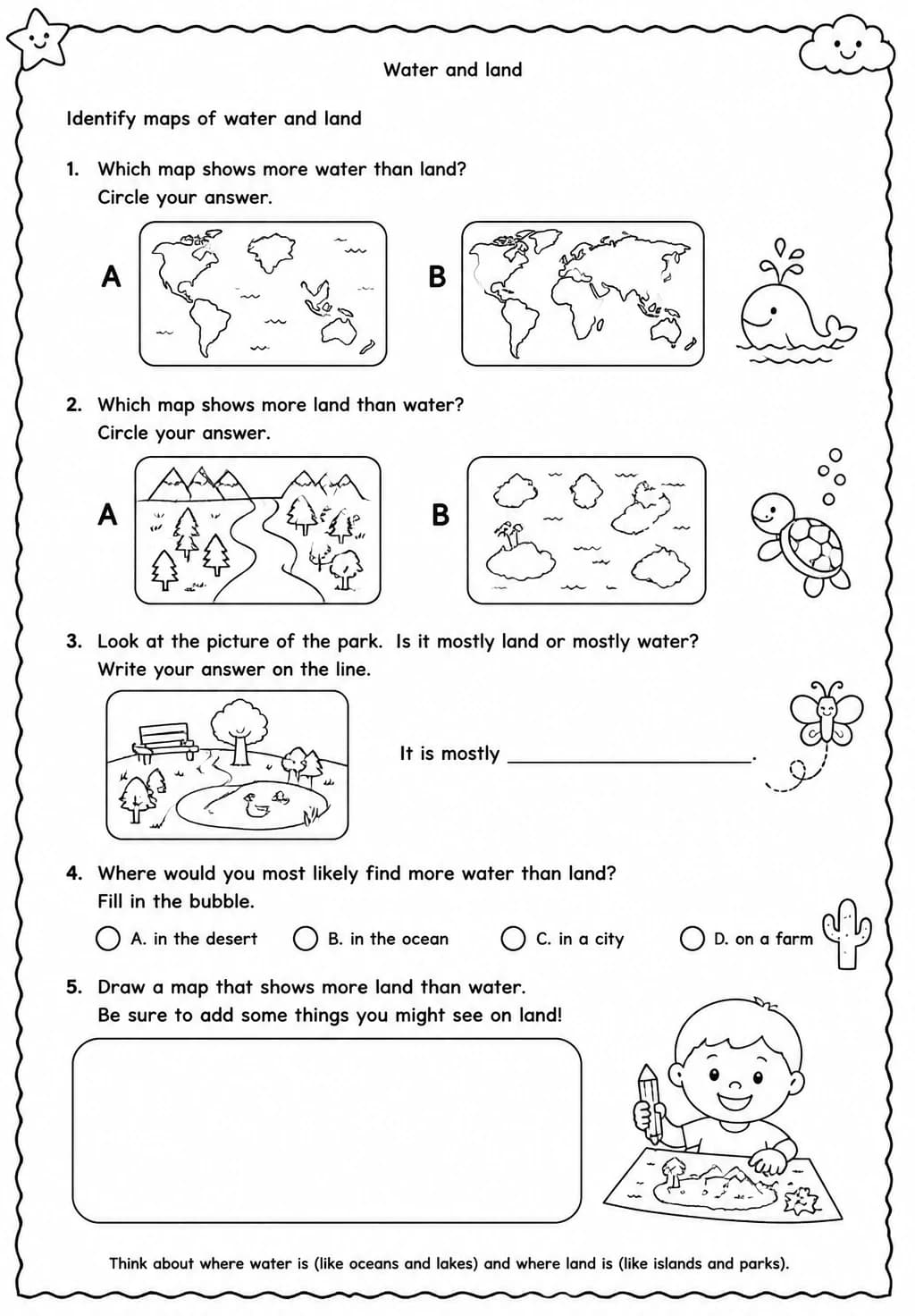
Identify maps of water and land
Free printable Grade 2 science worksheet for "Identify maps of water and land" — practice water and land. No-prep, print or assign online.
Grade 2 students identify water and land regions on maps, connecting map features to real geographical distinctions between oceans, rivers, lakes, and continents in this Earth and Space Science worksheet. Teachers can use it as a map skills activity after introducing basic geography, pairing it with a globe or classroom atlas for hands-on comparison. The worksheet builds early geographic literacy within the Water and Land strand, helping students connect map symbols to physical Earth features.
Learning objectives
- Identify water and land regions on a given map using standard map features
- Name common bodies of water and landforms found on maps
- Explain the difference between land and water as shown on a physical map
How to use this worksheet
- Click “Download Worksheet” and sign in with Google or email to get the PDF instantly.
- Print at home or in class for Grade 2; it's no-prep, with no extra materials needed.
- Hand it out as classwork, homework, or a quick warm-up.
Frequently asked questions
Is the “Identify maps of water and land” worksheet free?
Yes. “Identify maps of water and land” is a free printable Science worksheet. Sign in with Google or email to download the PDF instantly.
What grade or age is this Science worksheet for?
It's designed for Grade 2 (ages 7–8), covering Water and land.
Do I need to prep anything?
No. It's a no-prep, print-and-go worksheet — just download and hand it out.
Create more worksheets in our Worksheet Studio
Generate fresh worksheets for any grade, topic, and language — free.
Open the Worksheet Studio